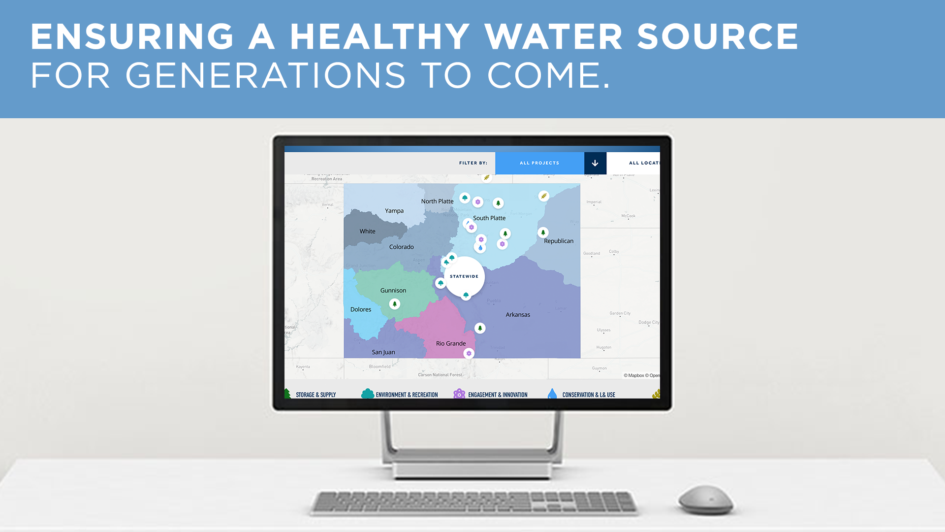
Today, we’re thrilled today to unveil the Colorado Water Plan Grant Projects Map. This new, interactive resource illustrates the work happening across Colorado to ensure we have ample clean water supplies alongside healthy flowing rivers.
The water Coloradans use to drink, irrigate crops, recreate, and sustain our communities is water that we share with our rivers, streams, and lakes. But climate change and population growth are straining water supplies across our state. Colorado’s Water Plan provides a blueprint to ensure we can meet future demands while also keeping our rivers healthy and flowing. The Plan includes local projects that can help make our communities more sustainable, ensure safe drinking water for all Coloradans, help our economy thrive, and protect water resources and wild ecosystems for future generations.
This interactive map includes projects that have been awarded grants via the state’s Water Plan Implementation Fund as well as potential future projects that have been developed by local stakeholders demonstrating the need for additional funding. The publicly funded Water Plan Implementation Grant Program assists with improving stream flows, decreasing pollution, and ensuring we have ample clean water for decades to come.
What this map can show you:
- Where conservation is already happening. Learn more about innovative projects across the state that are restoring rivers, protecting wildlife, and helping keep Colorado a wild and beautiful state for future generations.
- What’s still to come. Explore future projects in their conceptual phases to see if your community may be next to benefit and to get a sense of how much additional funding is still needed.
- How taxpayer dollars are reinvested in your community. See how these state initiatives are utilizing taxpayer revenue to safeguard Colorado’s rivers in your community and throughout the state.
How to use this map:
- Scroll to the top of the map to filter by location. See all ongoing and future projects in specific river basins, like the Colorado, the South Platte, or the Rio Grande. (Hint: Refresh the webpage to re-populate the map with all projects in all basins).
- Scroll to the top of the map to filter by project type. See all ongoing projects, separated by project type, happening throughout the state, like conservation and land use or agriculture. (Hint: You can also filter by scrolling down to the legend below the map and clicking on a project category).
- Click on the statewide bubble in the center of the map to see initiatives that are being implemented all over the state. See statewide endeavours like the Young Farmers and Ranchers Water Leadership Program or the For the Love of Colorado Public Education Initiative.
- Click on any project to zoom in and learn more about it and how it’s benefiting the surrounding community. For instance, zoom in on River Center Education Programs in Eagle, Pitkin, and Garfield counties to see how school field trips, college internships, and workshops for water professionals are driving engagement and innovation in each county.
- Click on projects marked with a shock of wheat to understand state initiatives reducing water consumption in agriculture. Learn more about Colorado-specific protocols like food asset mapping that reduce agricultural water consumption.
- Click on projects marked with a water droplet to see conservation and land use efforts. Projects like these strategically utilize existing infrastructure and stormwater to bolster rainfall and river flow water levels for the most efficient water use.
- Click on projects marked with a pine tree to look at storage and supply initiatives. Read more about the Prewitt Reservoir Dredging project that will restore about 1,600 acre-feet of storage to Prewitt Reservoir, while using dredged materials to create an island habitat environmental enhancement site.
- Click on projects marked with a gear to see engagement and innovation in water conservation and education. Learn more about education and community outreach projects like the Water in the Real World: Youth Education in the Rio Grande Watershed program for K-12 students.
- Click on projects marked with an oak tree to explore environment and recreation opportunities. See ongoing environment and recreation initiatives like the Del Norte Riverfront Project dedicated to habit restoration and construction for boating activities.
- Click on projects marked with a construction sign to see where future projects could come to fruition. Discover upcoming plans like the Audubon Nature Preserve Wetlands Improvement Project to learn more about what kind of initiatives will hopefully be coming down the pike in future years–if we can get the funding to support them.
Colorado faces real challenges to ensure a sustainable future, but we have a plan to tackle them and keep our communities and ecosystems safe and healthy. We hope you’ll join us by using the map and sharing it with your friends and colleagues!